Elected and planning officials from municipalities along Washtenaw Avenue have increasingly touted the vision and benefits of the Reimagine Washtenaw project as plans take shape.
But what exactly would a “complete street” on Washtenaw Avenue that caters to public transit, pedestrians and bicyclists look like? And how does less traffic impact the street's physical complexion?
ReImagine Washtenaw's architects offered three scenarios for public discussion at a series of meetings last week, though they stressed the scenarios are only options for consideration and they are continuing to gather feedback.
But Neil Billetdeaux, a consultant with Smithgroup JJR, said the aim of each is to reduce traffic and increase use of other forms of transit.
“The goal is to provide options, more options than is available today so people can make that choice,” he said.
The three scenarios will be online Monday and residents can leave feedback on the website.
Each scenario offers a mix of different proposals, though each includes connecting sidewalks throughout the corridor, which runs from the Cross Street and Washtenaw split in the city of Ypsilanti to the Stadium and Washtenaw split in the city of Ann Arbor.
Planners also want to see bike lanes installed and bus ridership increased on the route that traverses Washtenaw, which is already the Ann Arbor Transit Authority's busiest.
Billetdeaux said the four municipalities—the City of Ann Arbor, Pittsfield Township, Ypsilanti Township and the City of Ypsilanti—working with urban design and transportation consultants have all committed to continuous, buffered bicycle lanes through individual non-motorized transportation plans.
“All the governments involved and stakeholders are aligned to what we feel needs to be done to improve the corridor,” Project Manager Nathan Voght said.
Parts of each scenario call for dedicated bus lanes, and the plans incorporate “transit signal priority” that would allow bus drivers to control when lights turn red or green. The faster service would in turn draw more people to public transportation, which is one of the project’s central goals, Billetdeaux said.

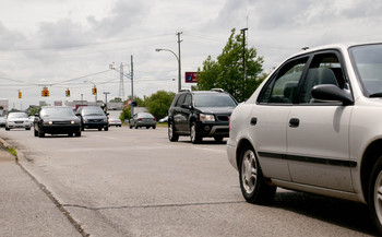
Officials are hoping to reduce traffic enough along a stretch of Washtenaw Avenue that it could implement a road diet to reduce it from five to three lanes.
Tom Perkins | For AnnArbor.com
Two of the scenarios also include road diets in the eastern part of the county, though Billetdeaux said such an idea is 20 to 30 years off and could only happen when traffic volume has been reduced.
“This is about a 20- to 30-year horizon on what Washtenaw wants to be, what the community wants it to be,” he said. “It represents a change in ridership, a change in transportation use in the corridor, and the three lane option under today’s conditions would fail, and no one is arguing that.”
Other ideas mixed into the scenarios include narrowing lane width; installing medians; adding mid-block crosswalks; adding landscape buffers and adding transit “super stops” that would attract more residents and offer better facilities for bus riders.
Ypsilanti City Planner Teresa Gillotti underscored that the focus at the moment is to gather feedback from residents on each of the ideas an plan’s components.
“We’re looking for feedback - nobody likes being on Washtenaw how it is now, so we want to hear if people want to have bike lanes, improved pedestrian crossings, where they want the crossings, bus pull offs so the traffic flow isn’t impeded. That’s what we want to hear from residents; what they like or don’t like,” she said.
Scenario A
Scenario A offers a cross-section that doesn’t look too much unlike Washtenaw Avenue today.
The five-lane road would include continuous, buffered bike lanes and sidewalks throughout the corridor. AATA buses would have transit signal priority and officials would better coordinate signals to improve flow.
The future public right-of-way would be expanded to 97-feet and still contain a dedicated center left turn lane. It also includes an eight-foot landscape buffer on each side of the road.
Scenario B
Scenario “B” would keep Washtenaw on the five-lane configuration on busier sections like between Stadium Boulevard and Platt Road. The corridor would narrow to four lanes between Platt and Carpenter, and include a median for part of that stretch.
East of Carpenter, the road would widen to five lanes until Torrey Street, where a road diet would take it down to three lanes until Cross Street. Parts of those stretches are where officials hope to see denser development that would include on-street parking.

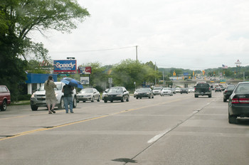
Reimagine Washtenaw's designers hope the plan will improve pedestrian safety by adding more crosswalks, among other measures.
Tom Perkins | For AnnArbor.com
But Billetdeaux stressed the road diet would “not happen under current traffic conditions”, noting Washtenaw sees 26,000 to 45,000 cars travel each direction daily.
“It would be a horrible idea to go and do that today and create a deadlock,” he said. “The goal is not to slow down traffic so people take buses.”
Sarah Binkowski, a transportation engineer with Parsons Brinckerhoff, said the traffic count would need to be reduced by 15 percent, or 200 vehicles per hour, to make the scenario feasible. That would require an increase in bus ridership, bike traffic and foot traffic.
Gillotti pointed out the importance of gaining the support major local employers like Saint Joseph Hospital, the University of Michigan and Eastern Michigan University.
Planners are beginning to meet with those employers and discuss ideas such as changing shifts to begin and end at off-peak hours or offer incentives for employees who take public transit and other means to commute to work.
“We want to have less people driving through peak traffic hours for this to work,” she said. “So if we can get them to talk to their staff, students and faculty about the bus, car pooling, or biking, then that helps make this much more realistic."
Like scenario “A”, scenario “B” includes continuous, buffered bike lanes and would provide AATA buses transit signal priority. Additionally, bus queues along the corridor would allow buses stopped at lights to jump ahead of traffic.
Billetdeaux said he heard the most support for scenario “B” during the four meetings with the public, which he partially attributed to the different lane configurations matching the current or proposed land use in each section.
“I’d also like to think that people are realizing that we don’t have to design our roadways and corridors based on the automobile anymore and we have to consider the pedestrian environment and land use,” he said.
Scenario C
Scenario “C” would keep Washtenaw a four-lane road divided by a 45-foot median between Stadium and Carpenter, then shift to a three-lane road with two additional dedicated bus lanes. It would also include continuous sidewalks, continuous bike lanes, bus queues and transit signal priority.

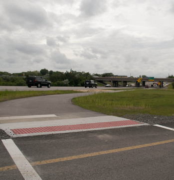
A new non-motorized path under U.S. 23. Reimagine Washtenaw hopes to extend it the length of the corridor.
Tom Perkins | For AnnArbor.com
Parts of scenario “C” would require at least 131 feet of public right-of-way, which Voght said would require businesses to either sell or donate part of their property. But he said that would happen piecemeal throughout the next 20 to 30 years and underscored that Reimagine Washtenaw does not plan to go out and purchase large swaths of land in the coming months.
Larry Krieg, a member of the Ypsilanti Township Planning Commission who has been involved in the committee-level discussions, said he believes developers and investors see the value in projects like Reimagine Wahtenaw that enhance the community.
“Business people are making an investment when they bring in a business and they want to see that the community to is willing to invest in itself,” Krieg said. “In other words, we cannot expect businesses to invest in us if we, the residents, aren’t willing to invest in ourselves. It’s up to us to get the ball rolling.”
Land use is a crucial part of the plan. Planners want to see building standards and zoning that promotes development that it is closer to the street, denser and multi-storied. Those characteristics attract more foot and bike traffic and make it easier for people to access commercial space from public transit.
Kreig contended that its that type of development that will keep a younger generation that is less interested in the automobile in the area. That was one of the questions that sparked the Reimagine Washtenaw project, he said.
“How do we make our communities more attractive to talented, young people, many of whom are going to the east coast and west coast for a job and are really not interested in an environment totally dominated by automobiles?” he asked.
“Also, the way a lot of feel is that the corridor now - it’s ugly.”